Lake Malawi, June 2022. Compiled by Dr Elias Chirwa.
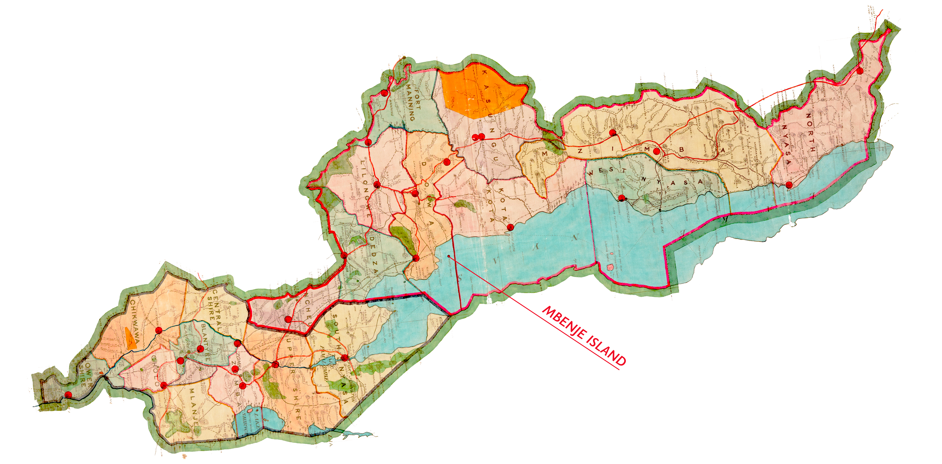
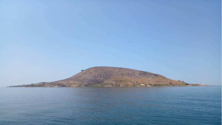
The Mbenji Island fishery is well known because of the success story of the community-based fisheries management system in place, with the fishery continuing to achieve optimum fish harvest during the yearly open fishing season. Our project is focused on examining the development and underpinning principles of this system in the mid-twentieth century in comparison with the centralised fisheries governance regime that was being constructed at the same time by the British colonial government.
Currently, however, there is a lack of scientific evidence surrounding the environmental conditions around Mbenji Island and how these contribute to the maintenance of fish stocks in these waters. We need to collect and analyse this data, including historical data surrounding changing environmental conditions and fish species over time through sediment analysis, in order to best contextualise the achievements of the Mbenji Island fishery.
From 15 June to 21 June 2022, the first trip of environmental sampling was carried out, focused on assessing water quality and fish stocks at three minor strata close to Mbenji Island in Nkhotakota District (minor stratum 5.1) and Salima District (minor strata 4.1 and 4.2).
Our main objectives were to collect nearshore water quality data to provide indices for ecosystem health.
The specific objectives were to:
1. Collect physico-chemical data at and around Mbenje Island
2. Collect biological data at and around Mbenje Island
Depth integrated physico-chemical sampling was carried out to collect data on such parameters as temperature, pH, specific conductivity, Secchi disk visibility depth, salinity, total dissolved solids, dissolved oxygen and soluble reactive phosphorous. The data will then be used to deduce the nutrient status of the water, which influences the natural production of food for the fish. Biological sampling was conducted to collect data on primary production to provide a measure of the amount food for the fish in the water. A healthy ecosystem would have adequate nutrients, increased food for the fish and a greater fish production. Knowledge on the ecosystem health of Mbenje and the surrounding waters is important so that we derive an understanding of the basis for any variations in fish production in the study area. This will address the question: “Are variations in fish production between Mbenje traditional fisheries and surrounding government-based fisheries a result of differences in management schemes or environmental conditions?”
Materials and Methods
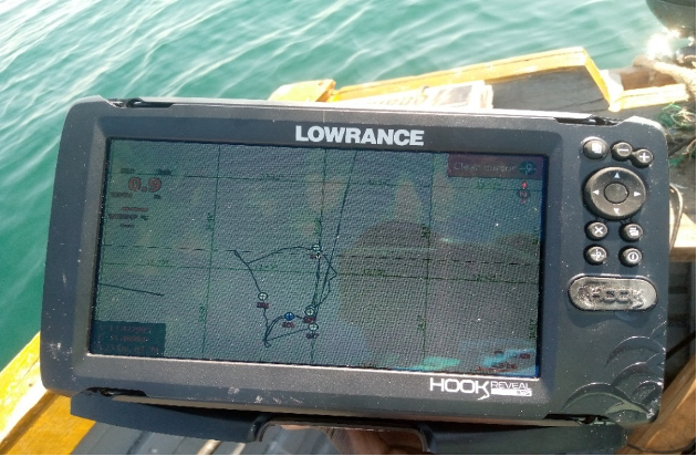
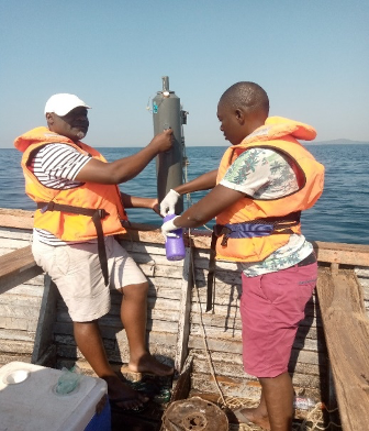
The study was conducted in Salima and Nkhotakota districts in minor strata around Mbenji Island. A total of two shallow stations and two deep stations were sampled during the study period for both physico-chemical and biological assessment of the water quality team per minor stratum. A boat was used for lake transport. An integrated Global Position System (Lowrance fish reviewer 9) fitted with a triple shot skimmer transducer was used to collect depth (m) information and corresponding coordinates at site.
| Site Name | Latitude | Longitude | Secchi depth (m) | Maximum Depth (m) |
| Chikombe 1 Deep | -13.48328 | 034.43077 | 5.5 | 44 |
| Mbenji Island | -13.43627 | 034.48634 | 7.2 | 7.5 |
| Chikombe 1 Shallow | -13.51637 | 034.38595 | 3.5 | 4.2 |
| Chikombe 2 Deep | -13.44342 | 034.41578 | 6.7 | 46 |
| Chikombe 2 Shallow | -13.48735 | 034.38319 | 3.5 | 7.3 |
| Senga Bay Shallow | -13.73773 | 034.61641 | 4.8 | 5.5 |
| Senga Bay Deep | -13.73691 | 034.65171 | 7.0 | 55 |
| Lifuwu Shallow | -13.68171 | 034.59953 | 3.9 | 6 |
| Lifuwu Deep | -13.67698 | 034.65873 | 7.5 | 41 |
| Chiluwa Deep | -13.73769 | 034.61460 | 8 | 40 |
| Chiluwa Shallow | -13.39271 | 034.33302 | 4.5 | 5.8 |
Physiochemical Assessment
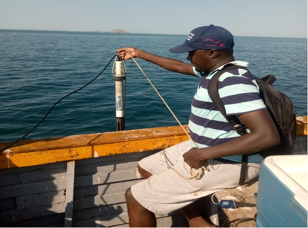
At each of the sampling station, pH, temperature, dissolved oxygen, salinity and conductivity were measured in-situ using Hydro lab MS5 series Multi-parameter Sonde.
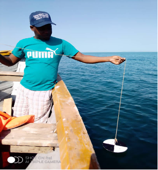
Transparency was determined by manual deployment of the Secchi disk (a white and black disk with 30cm diameter attached to measuring line). The depth at which the disk was no longer visible was the measured Secchi depth.
Soluble Reactive Phosphorus (SRP), being an important determinant of the lake’s primary productivity, was also measured. Part of the water sample collected for chlorophyll ‘a’ analysis was used in the Soluble Reactive Phosphorous analysis.
Biological Assessment
Biological parameters assessed comprised of phytoplankton biomass estimation using chlorophyll ‘a’ concentration and zooplankton species composition. For phytoplankton biomass, water samples from each sampling station were collected from different depth using a Niskin bottle and then transferred into a 1250ml sample collection bottle (figure 4). The samples were kept in a cooler box packed with ice and transported to Senga bay fisheries limnological laboratory for the analysis of Chlorophyll ‘a’ and nutrients.
Part of the water sample collected for chlorophyll ‘a’ analysis was used in the determination of Soluble reactive phosphorous analysis.
For zooplankton, water samples were collected in a single haul from each of the surveyed stations using a 30cm diameter Nitex plankton net with 80µm mesh zooplankton net, connected to a 100ml bottle at the base.
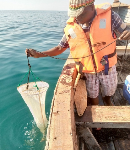
Samples for zooplankton were immediately transferred into 250ml polypropylene bottles soon after collection and fixed in 70% ethanol concentration before being taken to Senga Bay Fisheries wet laboratory for counting.
Next steps
After assessing nutrient status of the waters and their level of fish food, the next environmental sampling activities will comprise the following:
- Collect secondary data in form of fish catch and effort statistics. The data will be used to derive indices of fish productivity such as catch per unit effort and maximum sustainable yield which will be compared with the current yield to deduce the level of fish exploitation. This will address the question: “Is the fish productivity at Mbenje traditional fisheries truly different from the surrounding government-based fisheries?”
- Collect nearshore sediment core samples and send to UoS for analysis to determine legacy pollutants and community taxa. The data will be used to confirm the ecosystem properties of the Mbenje and surrounding waters to address the question: “Could variations in fish production between Mbenje traditional fishery and the surrounding government-based fisheries be explained by historical environmental (or palaeolimnological) changes in the study area?”
- Fish sampling to collect primary data on size/weight of fish at capture which will be used to provide indices of overfishing, the well-being or condition of the harvested fish and the health of fish stocks. The data will answer the question: “Is the health of fish stocks at Mbenje traditional fisheries truly different from the surrounding government-based fisheries?”
- Collect data on illegal, unreported, unregulated (IUU) fishing activities to determine the effectiveness of the prevailing fisheries management scheme.
- Collect summertime depth integrated physico-chemical data to provide indication of seasonal variations in environmental conditions in the study area.
The data collected through the above actions (except for sediment analysis to be undertaken at UoS) will be taken to Mzuzu University for analysis to generate information that will highlight the success of the traditional fisheries management scheme as compared with the government-based management regime, and the lessons for application in other parts of inland waters in Malawi and other countries.